From Sky to Soil: How Farmers Spot Crop Stress Faster Than Ever
When crop stress hits a field — whether it’s drought, nitrogen deficiency, or pests — the sooner you catch it, the better your chances of protecting yield.The challenge has always been seeing the problem early enough. Walking fields takes time. Stress often starts small. And by the time symptoms are obvious from the ground, damage may already be done.
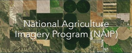
The National Agriculture Imagery Program (NAIP) is managed by the USDA’s Farm Service Agency (FSA and provides aerial imagery of farm land during the growing season. Growers get the best of both worlds when they combine NAIP imagery (broad, consistent, historical) with drone data (ultra‑detailed, on‑demand). Used together, they create a powerful, multi‑scale view of fields that neither dataset can provide alone.
That’s why more growers are using three sources: NAIP imagery for the big picture, drones for the close‑up, and boots on the ground for confirmation. All together, they create a fast, reliable way to diagnose issues before they spread. Below is a simple three‑step progression that shows how this works in real life.
NAIP: Spotting Stress From Above
NAIP images are a wide‑area aerial photos captured during peak growing season. Even at 1‑meter resolution, stress patterns jump out: pale patches from drought, striping from nitrogen issues, or irregular blotches from pests.
NAIP doesn’t tell you exactly what’s wrong, but it tells you where to look. It’s the early warning system that highlights hotspots across the entire field.
Drone Imagery: Zooming In on the Hotspot
Once NAIP points you in the right direction, a drone flight gives you the detail you need
Here you can see:
- Canopy gaps
- Leaf discoloration
- Height differences
- NDVI stress signatures
- Pest‑damaged patches
This is where the mystery starts to unravel. The drone reveals what the stress looks like up close, helping you narrow down the cause.
Ground Truth: Confirming the Diagnosis
This is the “boots on the ground” moment — the part where you walk into the hotspot and see the plants for yourselfMaybe the leaves are curled from . drought. Maybe the mid‑rib is yellow from nitrogen deficiency. Maybe pests have chewed through the canopy.
Whatever the cause, ground truthing connects the dots between what you saw from the sky and what’s actually happening in the field.
Why This Workflow Works
By combining NAIP, drones, and ground truth, farmers get a complete picture:
- NAIP shows the pattern
- Drones show the symptoms
- Ground truth shows the cause
It’s fast. It’s accurate. And it helps you make decisions with confidence — whether that means adjusting irrigation, correcting nutrient issues, or stopping pests before they spread. This layered approach isn’t just high‑tech. It’s practical, affordable, and increasingly essential for protecting yield in a world where every acre counts.
To introduce you to our mapping service, we will produce a map showing your farm including fields you lease. Just fill out the form below.